Global Unmanned Systems in Hamilton Hill, Western Australia, has been created to unlock the potential of the use of UAVs as cost effective tools for data acquisition and monitoring, particularly in the extractive industries
Sensorem in Inglewood, Western Australia, uses the latest in aircraft and sensor innovation, design and technology, to assist our clients in discovering new possibilities in aerial photography, cinematography and survey.
Coptercam, based in Australia, is the result of a vision: To create a dynamic UAV services provider that helps organisations integrate UAVs into commercial applications.
High Vision Photography is located in the United Kingdom. You can forget expensive hiring’s of cherry pickers or scaffolding as platforms for a photographer to get the shots that you need. Our 100ft mast systems are operated by photographers…
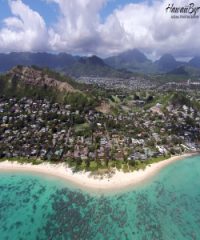
HawaiiByAir is a professional aerial photography & videography company based out of Kamuela. We strive to capture beautiful shots from the skies when & where you need them! We fly the latest in multi-rotor technology, with full video…


