
Based in Ontario, Canada. Beginning in 2009, RC Media was inspired to use our passion for new and exciting technology to capture aerial media through the use of drone platforms.
-
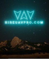
 Drone Light Show
A Drone Light Show is a swarm of drones performing a…
-
Drone Sales and Maintenance
The key to a good drone business is the right equipment.…
-
drone shows
-
Drones for Aerial Film and Photography
Drones are the perfect tool for skilled pilots and photographers to…
-
Drones for Legal Cases, Law Offices
Drones are the perfect tool for supplementing a legal case. Law…
-
Drones for Special Events
Drones grab people’s attention, and give people an experience unlike any…
-
Drones for Weddings
Drones can take a traditional photography package for a wedding to…
-
Drones in Mapping, GIS, and Surveying
Drones are the perfect tool for gathering data for mapping, surveying,…
-
Drones in precision agriculture
Drones are the perfect tool for skilled pilots and photographers to…
-
Drones in Real Estate and Construction
Drones in real estate and construction are a staple. Drones can…
-
Drones in Search and Rescue
Drones are great for search and rescue. Drones can use live…
-
Drones in Structural Inspection and Auditing
Drones are great at doing structural inspection and auditing. For bridges…
-
FAA Section 333
A Section 333, granted by the FAA, allows drone operators, pilots,…
-
Jamaica drone show
-
las vegas drone show
-
Los Angeles Drone Shows
-
Puerto Rico drone shows
Cardon Aerial Imaging has combined 13 years of aviation experience with our photography and video skills to provide an excellent service. Remote piloted Bergen Observer A/P helicopter with a 26cc gasoline engine, 6′ long with a redundant…
At Chopperpix, you’ll find a unique solution for your aerial photography needs. We specialize in affordable low level aerial photography, aerial spherical panoramas, and Hollywood-style aerial video services. Chopperpix provides a number of…
Flying Media provides custom aerial photography used by the commercial and residential real estate, construction, architecture, insurance, legal, and surveying industries. We serve the Pennsylvania area, and are based out of Lancaster. Aerial…
Only Flying Machines is a website is and business is based outside China, and is maintained under the strict supervision of AliShanMao of YouTube