
Hire a Drone Light Show in San Antonio
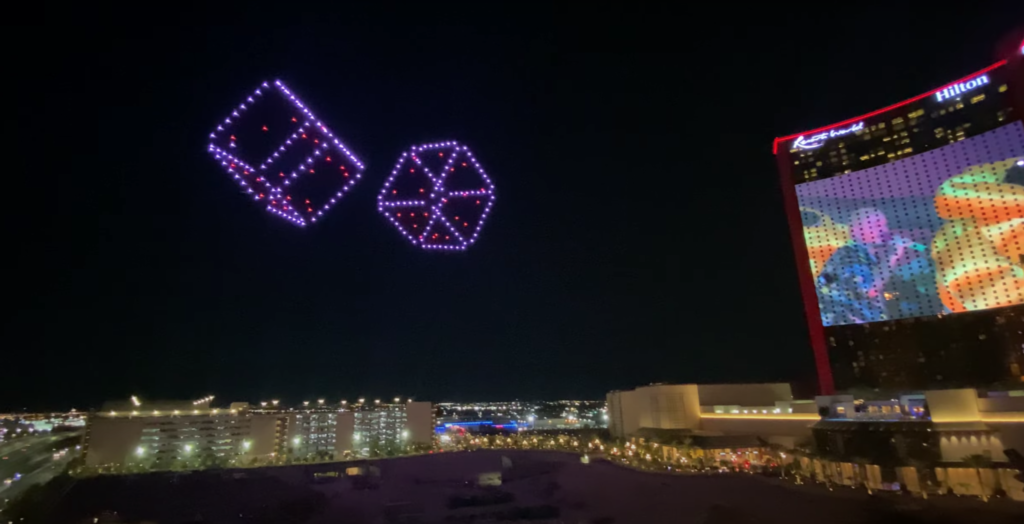
San Antonio is built for a night-sky show. A river that draws crowds through the middle of downtown, a stadium and arena district that fills for major events, resorts along the Hill Country edge, and one of the biggest festival calendars in Texas. Hire UAV Pro brings 50 to 5,000 drones, FAA Part 107 certified pilots and $10 million in insurance, with travel built into the quote.
1,000+
Shows flown
$10M
Insured
50–5,000
Drones per show
A Show We Have Flown in San Antonio
We produced a 300-drone show in San Antonio on our Damoda V4 system for a high-profile private event — custom animation, full production, and airspace authorization handled end to end. It is the scale most San Antonio clients land on: large enough to read clearly across a crowd, without the cost of a city-wide fleet.
Where San Antonio drone shows fly
The River Walk and the downtown river bend draw the biggest crowds, and Hemisfair gives open ground close to the centre. The Alamodome and the arena district work well for stadium-scale audiences, and resort properties along the northern edge of the city suit private and corporate events. Ranch venues in the Hill Country outside town give the clearest airspace and the darkest skies of anywhere in the region.
Season and weather
Spring and autumn are the easiest months here. Summer shows fly late, once the heat drops and full darkness arrives, which in June and July can mean nine o’clock or later. Spring brings storm risk, so every booking in that window carries a planned backup date. Winter is reliable and increasingly busy for corporate and holiday events.
San Antonio airspace
San Antonio International sits close to the north of downtown, and Randolph and Lackland Air Force Bases shape the airspace east and south-west of the city. Stadium events carry their own temporary flight restrictions. None of that rules out a show, but it does mean the venue determines what is possible. Send us the location first and we confirm the airspace before anything else is planned.
Festivals and city events
San Antonio runs one of the busiest event calendars in Texas, and a drone show gives a festival a closing moment that fireworks increasingly cannot — no fire risk during a dry Texas summer, no debris over the river or the crowd, and the ability to put a sponsor logo or a message in the sky. For multi-night events, additional performances cost far less once the crew and fleet are on site.
What every show includes
Custom show design previewed in 3D before approval, the drone fleet sized to your audience, FAA Part 107 certified pilots and ground crew, airspace authorization and FAA coordination, $10 million insurance with certificates issued to your venue, site survey and crowd separation planning, music synchronization, and full production and teardown.
Drone Light Shows for San Antonio Sports and Stadium Events
San Antonio is a Spurs town first. The NBA franchise drives the city’s biggest marketable nights, from tipoff and rivalry games through playoff runs and banner celebrations, and the ecosystem around it gives sponsors plenty of surface area. San Antonio FC carries professional soccer in the lower divisions with a committed supporter base, UTSA Roadrunners football has built a real college following, and Fiesta San Antonio turns the whole spring into an event calendar of its own. An aerial display works for a watch party, an arena plaza activation, a fan fest, a season launch or a sponsor hospitality night, using seventy to three hundred or more aircraft.
Central Texas drought gives you a practical reason to skip pyrotechnics. County burn bans arrive most summers, and a venue holding a natural playing surface will not welcome shell debris. Drone formations put out no spark and leave nothing behind on the ground. Flights are led by FAA Part 107 certified pilots, insured to ten million dollars for aviation liability, and informed by well over one thousand productions already delivered. Tell us your dates through the contact form on this website.
San Antonio Has the Best Downtown Airspace of Any Major Texas City
This is the single most important fact on this page, and we have not seen another operator state it.
We queried the FAA’s UAS Facility Map feature service directly at the coordinates of each venue below, then cross-checked each point against the FAA’s Class Airspace service.
San Antonio’s entire downtown event core is Class G at the surface.
The Alamodome. Frost Bank Center. Hemisfair and the Tower of the Americas. The San Antonio River Walk. Woodlawn Lake Park.
Every one of them returns no UAS Facility Map grid cell, sitting in uncontrolled surface airspace. Which means no FAA airspace authorization is required for a Part 107 operation at or below 400 feet AGL at any of them.
No LAANC request. No further coordination. No 90-day federal process. For a show at the Alamodome or over Hemisfair, federal airspace is simply not on the critical path.
Why that is unusual, and what it is worth
Compare the rest of the market. Nearly a quarter of the mapped grid over New York City carries a zero-foot ceiling, and almost half of Newark’s does. Houston Hobby’s entire 747-cell facility map caps at 200 feet — there is not a single 300 or 400-foot cell anywhere in it, which puts downtown Houston, EaDo, the Museum District and NRG under a 200-foot ceiling or lower. In Fort Worth, Panther Island sits at a 50-foot ceiling under Meacham Class D. In Dallas, Addison Circle Park is zero.
San Antonio’s downtown has none of those problems. San Antonio International is Class C, not Class B — Texas has only two Class B airspaces in the entire state, at Dallas-Fort Worth and Houston Intercontinental — and the Class C grid does not reach the river bend.
Where the grid does apply
San Antonio International’s grid runs 401 cells with ceilings at 0, 50, 100, 150, 200, 300 and 400 feet, and it is LAANC-enabled, so where authorization is needed it processes in near real time rather than through a federal queue.
If your venue is north of downtown toward the airport, or out toward Randolph Air Force Base — whose grid caps at 300 feet — the answer changes and has to be checked by point. Stinson Municipal also carries a small pocket of cells that are not LAANC-enabled, meaning a manual FAA authorization rather than an instant approval.
The honest summary is that San Antonio rewards a venue conversation. Downtown, you have complete freedom and no paperwork. A few miles out, you have a grid with real variation in it. The difference is worth knowing before a date is promised, and it comes from querying the actual coordinates rather than reading the metro name.
Fiesta, and what that airspace position means commercially
Fiesta San Antonio is an eleven-day citywide festival each April with substantial measured economic impact, and its core footprint — Hemisfair, the River Walk, the Alamodome — is exactly the ground that sits in Class G at the surface.
An eleven-day festival in airspace that needs no authorization is one of the better-matched drone show opportunities in Texas. A multi-night run amortises the same fleet and crew across several performances, and the content can change night to night rather than being a single fixed sequence — which is a fundamentally stronger proposition than one holiday evening.
Stadium restrictions
A standing FAA restriction covers stadiums with a seating capacity of 30,000 or more during regular and postseason MLB, NFL and NCAA Division I football, plus NASCAR Cup, IndyCar and Champ Series races — a three nautical mile radius, surface up to and including 3,000 feet AGL, from one hour before the scheduled start until one hour after the end. It restricts all aircraft operations, unmanned included.
The Alamodome, at roughly 64,000 seats, is above the threshold and therefore covered during qualifying events. Frost Bank Center, at about 18,400 for basketball, is well below it and not covered by the standing restriction at all — which makes a Spurs night one of the more straightforward drone show prospects in the city, especially given its Class G surface position.
The key operational point is that the restriction is event-triggered, not permanent. A show at the Alamodome on a non-event date is unaffected. A show timed to an actual game has to address the window explicitly, and a post-game show needs the window addressed rather than assumed to have lapsed — the most common planning error at venues of this size. We verify your date against the FAA’s own Sporting Event Automated Monitoring System feed rather than reading a published schedule.
Burn Bans, Fireworks Law, and Why This Argument Is Strongest in Texas
Texas is the state where the fire argument for drone shows is not marketing. It is arithmetic.
How often Texas is actually under a burn ban
County burn bans are adopted under Texas Local Government Code § 352.081, declared by a county judge or commissioners court when drought conditions exist, and tracked by the Texas A&M Forest Service.
Texas has 254 counties. In a dry year, here is what the coverage looks like:
236 counties were under a burn ban on 1 July 2011 — described as a record at the time. 215 counties on 13 September 2023. 120 counties on 9 October 2024, including Harris, Fort Bend, Waller and Liberty.
So in a dry year, somewhere between half and over nine-tenths of Texas counties can be under a ban simultaneously — and 1 July is squarely inside that risk window, as the 2011 figure shows.
What a burn ban order actually says
We read the orders rather than summarising a news article about them.
A typical county order — Fort Bend County’s, adopted under § 352.081 — prohibits burning “outside of an enclosure designed to contain and capable of containing all flames, sparks, embers, cinders, and ash” across all unincorporated areas of the county. It stays in force until rescinded but may not extend beyond ninety days unless the commissioners court orders otherwise, and it lifts only when the Texas Forest Service ends its drought determination and the county judge agrees. Violation is a Class C misdemeanor with a fine up to $500. Exceptions are narrow: TCEQ-authorised firefighter training, utility and pipeline work, agricultural planting and harvesting, and certified prescribed burns.
The order does not mention drones or unmanned aircraft anywhere. Neither does the East Texas county order we pulled for comparison.
That is the point, stated plainly: Texas county burn ban orders, as written, regulate outdoor burning. A burn ban does not, on its face, restrict a drone light show.
The index behind the decision
Texas counties work from the Keetch-Byram Drought Index, a 0-to-800 scale modelling soil moisture against an assumed eight inches of storage capacity, interpolated county by county by the Texas A&M Forest Service.
The bands matter because they describe what your venue’s grass is actually doing. 400 to 600 is “typical of late summer, early fall”, where lower litter and duff layers “contribute to fire intensity and will burn actively.” 600 to 800 is “often associated with more severe drought with increased wildfire occurrence,” where “intense, deep-burning fires with significant downwind spotting can be expected” and live fuels burn actively.
There is no published numeric threshold that automatically triggers a ban — the decision sits with the commissioners court. Which is exactly why it is unpredictable from an event planner’s chair, and why building a summer outdoor celebration around combustion in Texas carries a risk that cannot be scheduled away.
What a professional display needs, and what we don’t
Fireworks displays in Texas run through State Fire Marshal licensing under Occupations Code Chapter 2154 — licensed pyrotechnic operators, permits, storage and site requirements. A separate county power under the Local Government Code also lets commissioners courts restrict the sale and use of certain fireworks in unincorporated areas during drought.
All of it regulates pyrotechnics. None of it describes an aircraft.
A drone show in Texas is governed by the FAA under Part 107, by whatever land manager controls the ground, and by the venue’s own event permitting. It needs no burn permit, is unaffected by a county burn ban, and remains available under a venue’s no-open-flame policy or a golf course’s dry-grass advisory.
We carry $10 million in drone aviation liability. That is a figure you can check against any published floor — Ohio and Pennsylvania both set $1,000,000 for a fireworks display, Tennessee $1,000,000 for a licensed exhibitor, North Carolina $500,000 for a display operator. Our coverage is multiples of all of them.
When To Fly in San Antonio, and What the Heat Actually Costs
We computed both of the figures below rather than looking them up.
San Antonio’s wind calendar runs backwards from most of the country
Mean daily wind at San Antonio International, from ten years of hourly observations, 2015 through 2024:
The calmest months are December at 6.0 knots, November at 6.1, January at 6.3 and September at 6.4.
The windiest are May at 8.5 knots, July at 8.3 and April at 8.2.
That is worth pausing on, because it inverts the usual advice. In most of the country the summer months are the calm ones and spring is the problem. In San Antonio, May through July is the windiest stretch of the year and the late autumn and winter are the calmest.
Which means the single most common scheduling instinct — put the show on 4 July — lands in a month that is, on average, two knots windier than November or December. Not prohibitive, but it is the opposite of what a planner would assume, and it is one more reason to look at the back half of the calendar.
Two useful consequences. A Fiesta show in April is in a moderately windy month and we would build contingency accordingly. A holiday or New Year’s Eve show in San Antonio is in the calmest airspace of the year, in a downtown core that needs no FAA authorization, at a time when a pyrotechnic alternative carries burn-ban exposure. On the data, that is the best-structured opportunity in the city.
Heat is the real constraint, and it is bigger than altitude
Static propeller thrust scales roughly with air density, so what governs aircraft performance is density altitude rather than field elevation. We computed the figures below from actual temperature, dewpoint and pressure, with the water-vapour term calculated properly — because moist air is less dense than dry air and in Texas that correction is not a rounding error.
San Antonio International sits at 809 feet field elevation. On a hot summer afternoon — 98°F with a 71°F dewpoint — the density altitude is about 3,975 feet.
That is a roughly 3,170-foot penalty over field elevation, from heat and humidity alone. In performance terms a fleet staging in that heat is operating as though it were at the elevation of a mountain town, in a city at 800 feet.
The number that actually matters: move the show to its real slot
Here is the part most operators never quantify.
Density altitude falls sharply after sunset. In the Dallas-Fort Worth data we computed the same two scenarios directly: a hot July afternoon runs about 3,844 feet density altitude, and the same location at 9 p.m. in July runs about 3,024 feet.
Moving a show from afternoon conditions to its actual evening slot recovers roughly 800 feet of density altitude.
So a crew staging, test-flying and verifying a fleet in San Antonio’s afternoon heat is working several hundred feet higher than the show itself will ever see. A pre-flight that passes comfortably at 3 p.m. has real margin by 9 p.m. — and one that looks marginal in the afternoon is not necessarily a problem at all.
Knowing which is which is the difference between an unnecessary scrub and a confident launch, and it only comes from computing the actual hourly data rather than quoting a field elevation off a chart.
And the humidity point, stated honestly
Gulf and South Texas humidity is a genuine factor, unlike in the desert Southwest. On a 95°F afternoon with a 76°F dewpoint, the water-vapour correction adds about 429 feet of density altitude over the dry calculation. In El Paso at 100°F with a 55°F dewpoint it adds only about 239 feet.
So any density altitude figure quoted for a humid Texas city without the humidity correction understates it by roughly 15%. We compute it. It does not change where San Antonio ranks against West Texas — El Paso runs 7,600 to 7,900 feet on a hot afternoon and Amarillo around 7,100 — but it does mean the number we give you is the real one rather than the flattering one.
The Questions San Antonio Producers Actually Ask
Do we need FAA authorization for a show downtown?
No. The Alamodome, Frost Bank Center, Hemisfair and the Tower of the Americas, the River Walk and Woodlawn Lake Park are all Class G at the surface — no UAS Facility Map grid cell, uncontrolled surface airspace. No FAA airspace authorization is required for a Part 107 operation at or below 400 feet AGL at any of them.
That is the best downtown airspace position of any major Texas city. San Antonio International is Class C rather than Class B — Texas has only two Class B airspaces in the whole state, at Dallas-Fort Worth and Houston Intercontinental — and the Class C grid does not reach the river bend.
How does that compare with Houston or Dallas?
Favourably, and the contrast is sharp. Houston Hobby’s entire 747-cell facility map caps at 200 feet — not a single 300 or 400-foot cell anywhere in it — which puts downtown Houston, EaDo, the Museum District and NRG under a 200-foot ceiling or lower. In Fort Worth, Panther Island sits at a 50-foot ceiling. In Dallas, Addison Circle Park is zero. San Antonio’s downtown has none of that.
So the airspace is never an issue here?
Downtown, effectively not. A few miles out, it is. San Antonio International’s grid runs 401 cells with ceilings from 0 to 400 feet and is LAANC-enabled, so where authorization is needed it processes quickly. But if your venue is north toward the airport, or out toward Randolph Air Force Base — whose grid caps at 300 feet — the answer changes. Stinson Municipal also has a pocket of cells that are not LAANC-enabled, meaning a manual FAA authorization rather than an instant one. We query the actual coordinates rather than the metro name.
Can we do a post-game show at the Alamodome?
Yes, outside the restriction window. The standing stadium restriction covers venues seating 30,000 or more during NFL, MLB, NCAA Division I football and major races — three nautical miles, surface to 3,000 feet AGL, from an hour before the scheduled start to an hour after the end. The Alamodome at roughly 64,000 is covered during qualifying events.
It is event-triggered, not permanent. A show there on a non-event date is unaffected. A post-game show must address the window explicitly rather than assume it has lapsed — the most common error at venues this size. We verify against the FAA’s own Sporting Event Automated Monitoring System feed rather than a published schedule.
Worth knowing: Frost Bank Center, at about 18,400 for basketball, is below the threshold entirely and not covered by the standing restriction. Combined with its Class G surface position, a Spurs night is one of the most straightforward drone show prospects in the city.
When should we schedule?
This is where San Antonio surprises people. The calmest months here are December at 6.0 knots mean daily wind, November at 6.1, January at 6.3 and September at 6.4. The windiest are May at 8.5, July at 8.3 and April at 8.2.
San Antonio’s wind calendar runs backwards from most of the country — May through July is the windiest stretch of the year, and late autumn and winter are the calmest. So a 4 July show sits in a month that averages about two knots windier than November or December. Not prohibitive, and the opposite of what most planners assume.
If your date has flexibility, a holiday or New Year’s Eve show is the best-structured opportunity in the city: calmest airspace of the year, a downtown core needing no FAA authorization, and a season when a pyrotechnic alternative carries burn-ban exposure.
What about Fiesta?
Strong fit, with one honest caveat. Fiesta’s core footprint — Hemisfair, the River Walk, the Alamodome — is exactly the ground that sits in Class G at the surface, so an eleven-day festival runs in airspace needing no authorization at all. A multi-night run amortises the same fleet and crew across several performances and lets the content change nightly, which is a fundamentally better proposition than one holiday evening.
The caveat is that April is a moderately windy month here at 8.2 knots mean, so we would build contingency into the run rather than treat a hold as a failure.
Can you fly during a burn ban?
Yes, and in Texas this is the strongest version of the argument anywhere in the country. Texas has 254 counties. 236 were under a burn ban on 1 July 2011; 215 on 13 September 2023; 120 in October 2024. In a dry year somewhere between half and over nine-tenths of the state can be banned at once — and 1 July sits squarely inside that risk window.
We read the actual county orders rather than a summary. A typical order under Local Government Code § 352.081 prohibits burning outside a containing enclosure across all unincorporated county areas, runs up to ninety days, and carries a Class C misdemeanor and a fine up to $500. It does not mention drones or unmanned aircraft anywhere. A burn ban, as written, does not restrict a drone light show.
Will the heat hurt our show?
Heat matters more than altitude here, and the useful thing is that it is quantifiable. San Antonio International sits at 809 feet field elevation, but on a hot summer afternoon — 98°F with a 71°F dewpoint — the density altitude is about 3,975 feet. That is a roughly 3,170-foot penalty from heat and humidity alone.
The number that matters, though, is what happens by show time. Computing the same pair of scenarios in the Dallas-Fort Worth data: a hot July afternoon runs about 3,844 feet density altitude and the same place at 9 p.m. in July runs about 3,024. Moving a show to its actual evening slot recovers roughly 800 feet.
So a crew test-flying in San Antonio’s afternoon heat is working several hundred feet higher than the show will ever see. A pre-flight that passes comfortably at 3 p.m. has margin to spare by 9 p.m., and one that looks marginal in the afternoon is not necessarily a problem. Knowing which is which is the difference between an unnecessary scrub and a confident launch.
Does humidity make the heat worse for the drones?
Yes, measurably, and we would rather give you the real figure than the flattering one. On a 95°F afternoon with a 76°F dewpoint, the water-vapour correction adds about 429 feet of density altitude over the dry calculation. In El Paso at 100°F with a 55°F dewpoint it adds only about 239 feet.
So any density altitude figure quoted for a humid Texas city without the humidity correction understates it by roughly 15%. It does not change where San Antonio ranks against West Texas — El Paso runs 7,600 to 7,900 feet on a hot afternoon, Amarillo around 7,100 — but it does mean our numbers are computed rather than rounded in our favour.
Should we replace our fireworks or add to them?
The documented Texas pattern in 2026 is hybrid rather than replacement, and we would rather describe the market accurately than oversell the switch.
Arlington’s “Light Up Arlington” ran fireworks and drones together as one coordinated production, launched from the same site, 9:30 p.m. for 18 to 20 minutes. Mansfield ran at least 400 drones including 50 carrying pyrotechnics, with the drones opening and the fireworks following — a supplement, not a substitute. Galveston did replace its 4 July fireworks with a 200-drone show, citing safety, no debris in the water and no loud bangs, though reporting suggests the island later moved back toward fireworks.
So in Texas, “drones alongside, or instead of, fireworks” is the honest framing. We will build either and tell you straight what each one costs.
How many drones do we need?
It depends on viewing distance and what you want the audience to read in the sky, not on a package tier. For in-state reference: Galveston carried a full 4 July replacement on 200 drones; Mansfield ran at least 400 as a hybrid. More drones means more resolution in the imagery rather than simply more lights. A River Walk show seen from a narrow corridor is a different sizing problem from an Alamodome show seen across open ground, and we size to the geometry.
Who else operates in Texas?
Sky Elements Drones is headquartered in North Texas and flew both the Galveston and Mansfield shows. We would rather tell you that than let you find it in a procurement meeting.
What we would ask you to compare is not drone count or mileage. It is whether the proposal in front of you tells you the grid ceiling at your exact coordinates, the stadium restriction windows against your exact date, the authorization timeline that follows from both, the density altitude at show time rather than at noon, and the liability limit standing behind it. Everything on this page is the output of that work.
Why hire a Colorado company for a San Antonio show?
Because what you are buying is the analysis on this page plus the aircraft and crew to execute it. That the entire downtown core is Class G at the surface while Houston Hobby caps at 200 feet statewide and Fort Worth’s Panther Island at 50; that Frost Bank Center is below the stadium threshold and the Alamodome is above it; that San Antonio’s windiest months are May through July rather than the spring; that a burn ban order does not mention aircraft; that show-time density altitude runs 800 feet below the setup hour — that is work done because it decides whether a show flies and on which date. We fly nationally, we carry $10 million in drone aviation liability, and we would rather tell you a venue or a date is wrong in the first conversation than in week eleven.
San Antonio drone show FAQ
How much does a drone show cost in San Antonio?
Fleet size drives the price, then custom animation, travel and show length. Our San Antonio show flew 300 drones. Every event is quoted individually with exact pricing within 24 hours — see the cost guide.
Can you fly over the River Walk?
It depends on the exact site and the airspace above it. Downtown river locations are workable with the right authorizations and enough lead time. Tell us the venue and we will confirm before you plan around it.
How many drones do we need?
Large public audiences viewing from a distance want 300 or more. Corporate events, weddings and private celebrations work well at 100 to 200.
How far in advance should we book?
Sixty to ninety days is comfortable. July 4th, New Year’s Eve and Fiesta week book earliest and sell out first.
Book a San Antonio drone show
Tell us your date, venue and audience and we will send a custom concept and exact pricing within 24 hours.
More Drone Light Shows in Texas
We fly across Texas. See all Texas drone light shows, or a nearby city or venue:
South Padre Island Beach · Space Center Houston · TCU · Texas A&M · The Alamo · Tyler · UT Austin · Arlington · AT&T Stadium · Austin · Baylor University · Beaumont